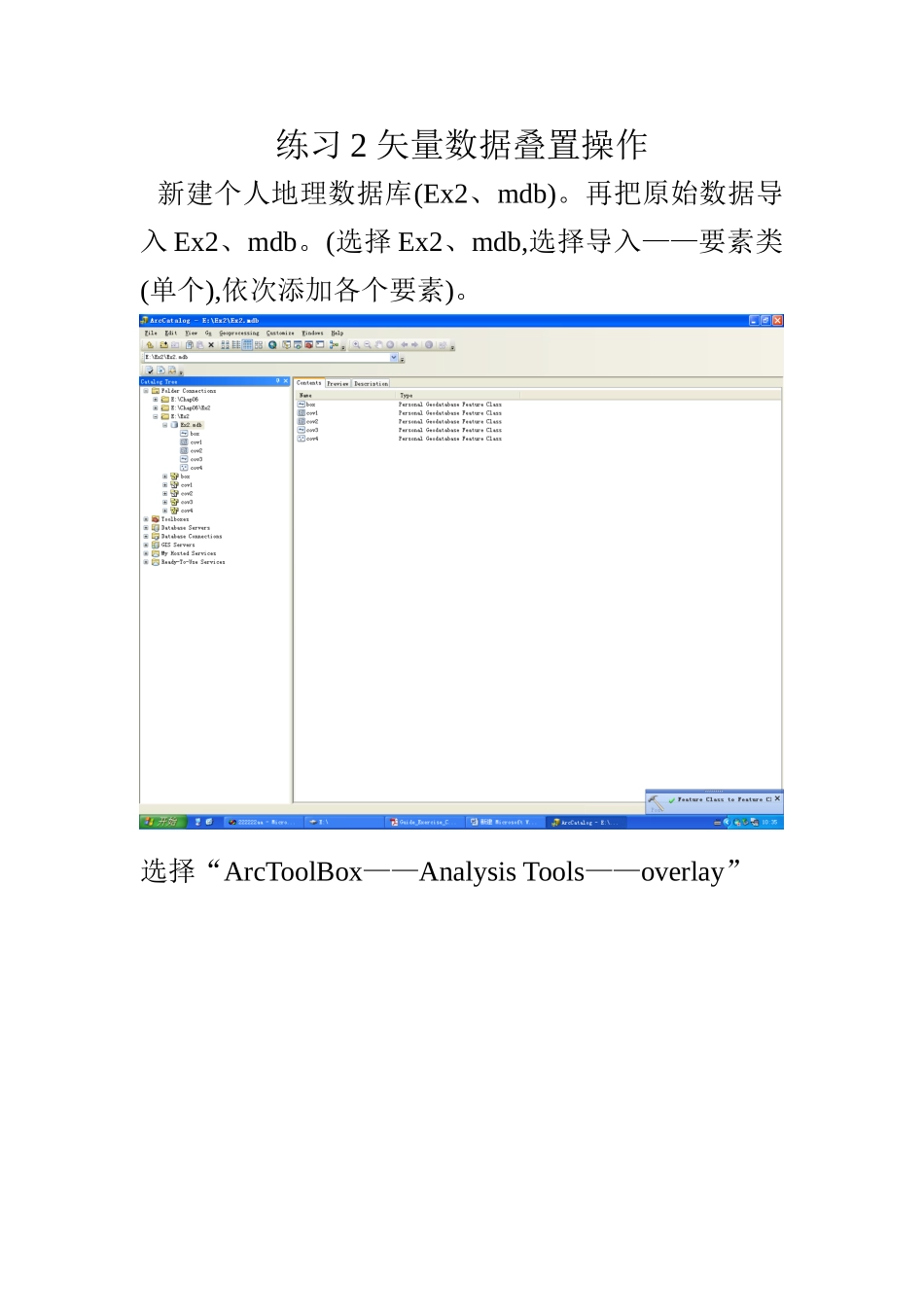
练习 2 矢量数据叠置操作新建个人地理数据库(Ex2、mdb)
再把原始数据导入 Ex2、mdb
(选择 Ex2、mdb,选择导入——要素类(单个),依次添加各个要素)
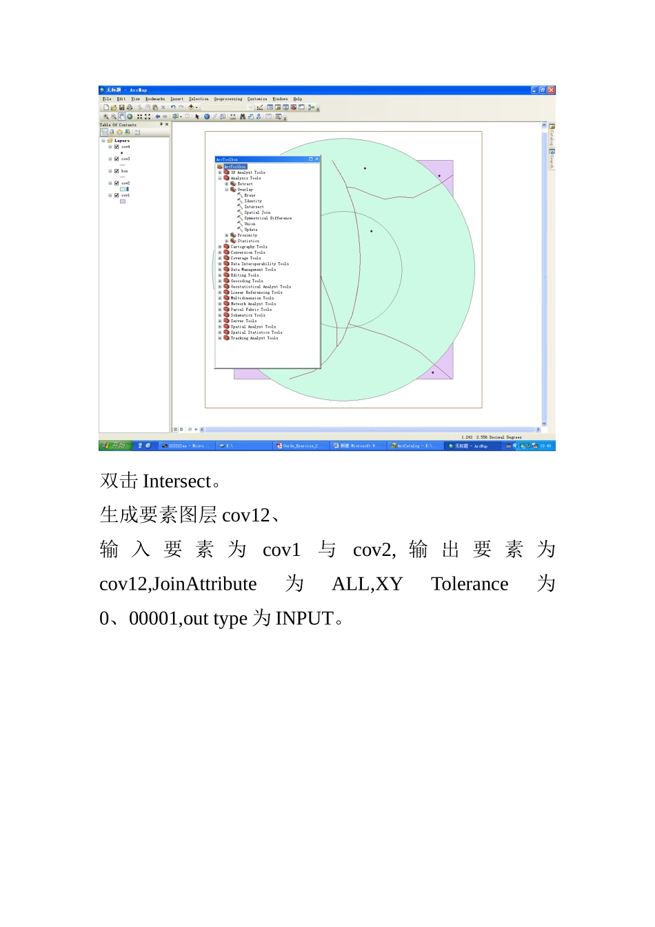
选择“ArcToolBox——Analysis Tools——overlay”双击 Intersect
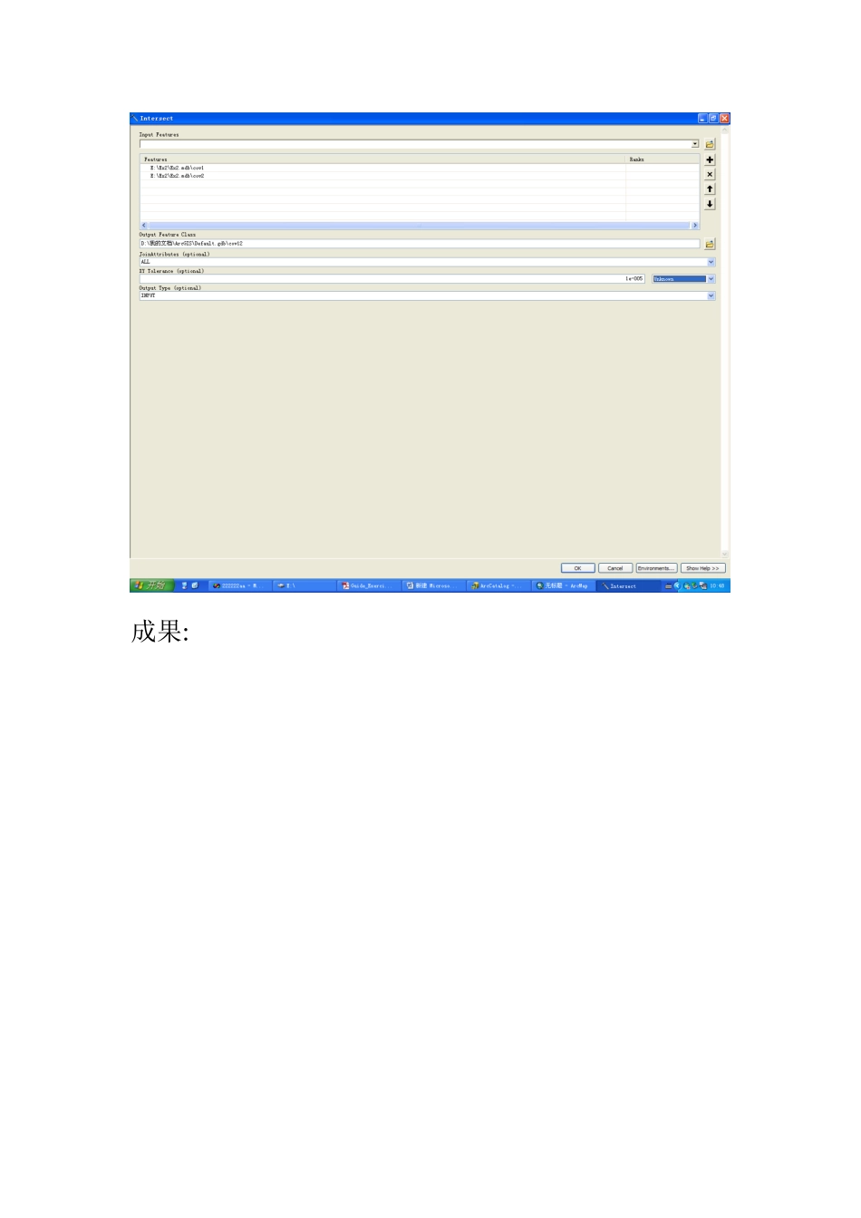
生成要素图层 cov12、输 入 要 素 为cov1与cov2, 输 出 要 素 为cov12,JoinAttribute为ALL,XY Tolerance为0、00001,out type 为 INPUT
成果:以同样得方法生成 cov32、(选择 cov3 与 cov2,生成cov32,JoinAttribute为ALL,XY Tolerance为0、00001,Out Type 为 line
)成果:生成要素图层 cov42、选择 cov4 与 cov2,生成要素为 cov42,JoinAttribute 为ALL,XY Tolerence 为 0、00001,Out Type 为 POINT
成果:成果:选择“ArcToolbox——Analysis Tools——overlay”
选择 Identify
生成要素图层 cov12b
Inout Feature 为 cov1,Identify Feature 为 cov2,Output Feature为cov12b
JoinAttributes为ALL,XY Tolerance 为 0、00001
成果为:生成要素图层 cov32b
Inout Feature 为 cov3,Identify Feature 为 cov2,Output Feature为cov32b
JoinAttributes为ALL,XY Tolerance 为 0、00001
成果为:生成要素图层 cov42b
Inout Feature 为 cov4,Identify