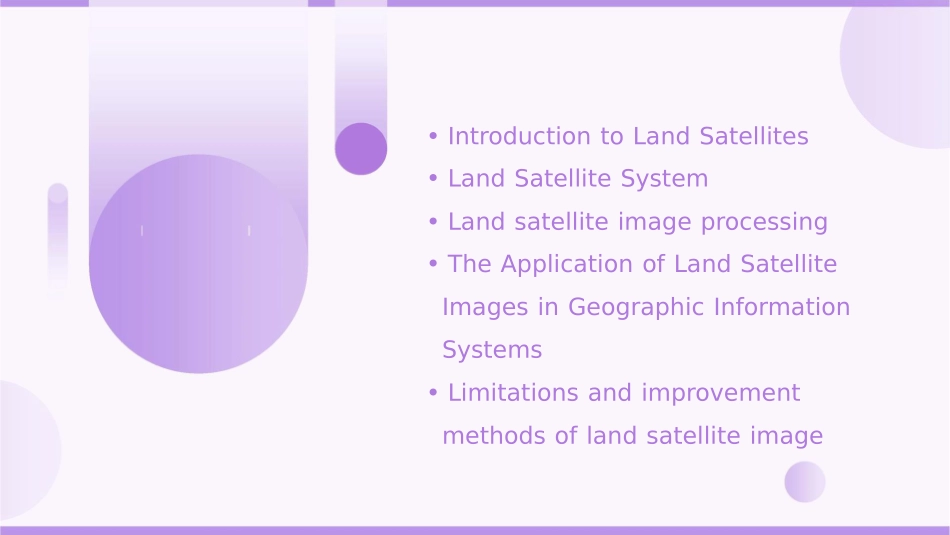
Englishversionoflandsatellitecourseware•IntroductiontoLandSatellites•LandSatelliteSystem•Landsatelliteimageprocessing•TheApplicationofLandSatelliteImagesinGeographicInformationSystems•Limitationsandimprovementmethodsoflandsatelliteimage01IntroductiontoLandSatellitesDefinitionofLandSatellite•Landsatellite:asatellitelaunchedtoorbittheEarththatisusedtocollectinformationabouttheEarth'ssurfaceandatmosphereItprovidesremotesensingdataforscientificresearch,environmentalmonitoring,naturalresourcemanagement,andotherapplicationsTheHistoryandDevelopmentofLandSatellites•Thefirstlandsatellite,Explorer1,waslaunchedbytheUnitedStatesin1958Sincethen,landsatelliteshavebeencontinuouslylaunchedandupdated,evolvingfromfilmbasedimagingtodigitalimagingandfromlowresolutiontohighresolutionimagingApplicationfieldsoflandsatellitesScientificresearchEnvironmentalmonitoringNaturalDisasterresourcemanagementmanagementLandsatellitesprovideremotesensingdataforgeological,LandsatellitescanLandsatellitescanhelpLandsatellitescanprovidetimelyremotesensingdatatosupportdisasterresponseandreliefeffortsmonitorglobalidentifyandmonitornaturalresourcessuchaswater,forests,andmineralsenvironmentalchanges,suchasclimatechanges,deforestation,description,andseaicemeltingmeteorological,ecological,andotherscientificresearchfields02LandSatelliteSystemCompositionofLandSatelliteSystemSpacesegmentUsersegmentDevicesandsystemsthatreceiveandusethedataprovidedbythesatellitesSatellitesthatorbittheEarthandcollectdataGroundsegmentInfrastructureonthegroundthatreceivesandprocessesdatafromthesatellitesThecharacteristicsofterritorialsatellitesystemsHighresolutionimagesLandsatellitesystemsprovidehighresolutionimagesoftheEarth'ssurface,enablingdetailedmappingandmonitoringGlobalcoverageTheorbitingsatellitesprovideglobalcoverage,allowingforcontinuousobservationoftheEarthRealtimedataThesystemprovidesreal-timedata,enablingquickresponsetonaturaldisastersandotheremergenciesTechnicalparametersoflandsatellitesystemsSatelliteorbitThetypeoforbitusedbythesatellites,suchaslowEarthorbitorgeographicorbitImagingresolutionThelevelofdetailintheimagesprovidedbythesatellites,measuredinmetersSpectralbandsTherangeofwavescapturedbythesatellite'ssensors,determiningthetypeofinformationobtainedRevisitfrequencyThefrequencyatwhichasatellitecanrevisealocationontheEarth'ssurface,affectingthetimelineofdatacollection03LandsatelliteimageprocessingAcquisitionofLandSatelliteImagesRemotesensingsatellitesGroundreceivingstationsDatatransmissionDatastorageandmanagementSentinel-2,Landsat,MODIS,etcresponsibleforreceivingandpreprocessingrawsatellitedatarawdataistransmittedtogroundstationsthroughmicrowavelinksorothercommunicationchannelsafterreceivingrawdata,groundstationsneedtobetostoreandmanagethemtoensuretheiravailabilityforfurtherprocessingTheprocessingflowoflandsatelliteimages•Level1:Radiometriccorrection:tocorrectthebrightnessofeachpixelandobservethereflectionofthegroundsurfaceApplicationofLandSatelliteImages01020304ResourcesurveyDisasterreliefLanduseplanningEnvironmentalmonitoringtoidentifyandmapnaturalresourcessuchasforests,waterbodies,andmineralsbasedonsatelliteimagestomonitorthestatusandchangesoftheenvironmentasairpollution,waterquality,andsoilerosiontoprovidetimelytoanalyzethespatialdistributionandinformationaboutdisasteraffectedareasandassessthedamagecausedbydisa...