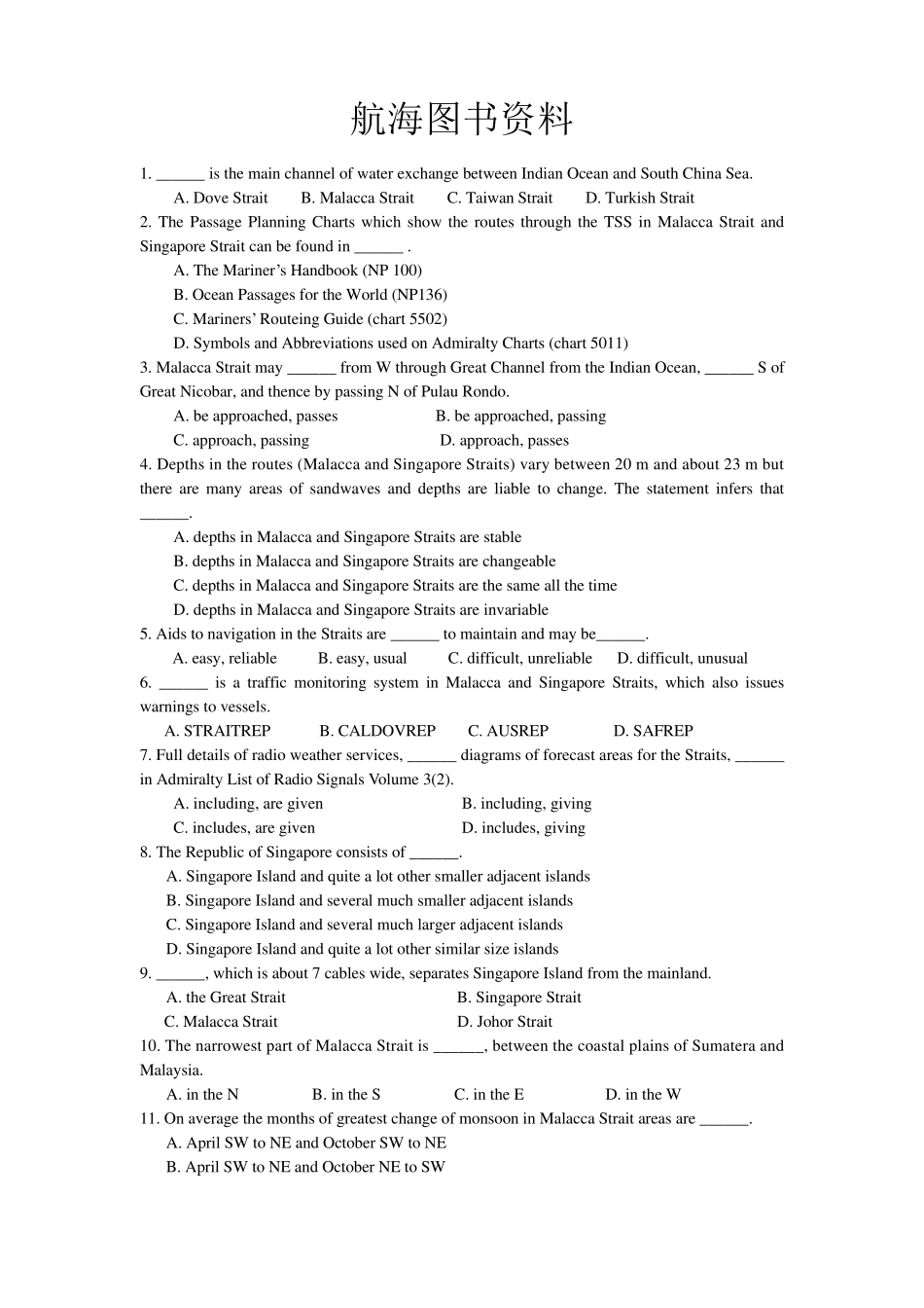
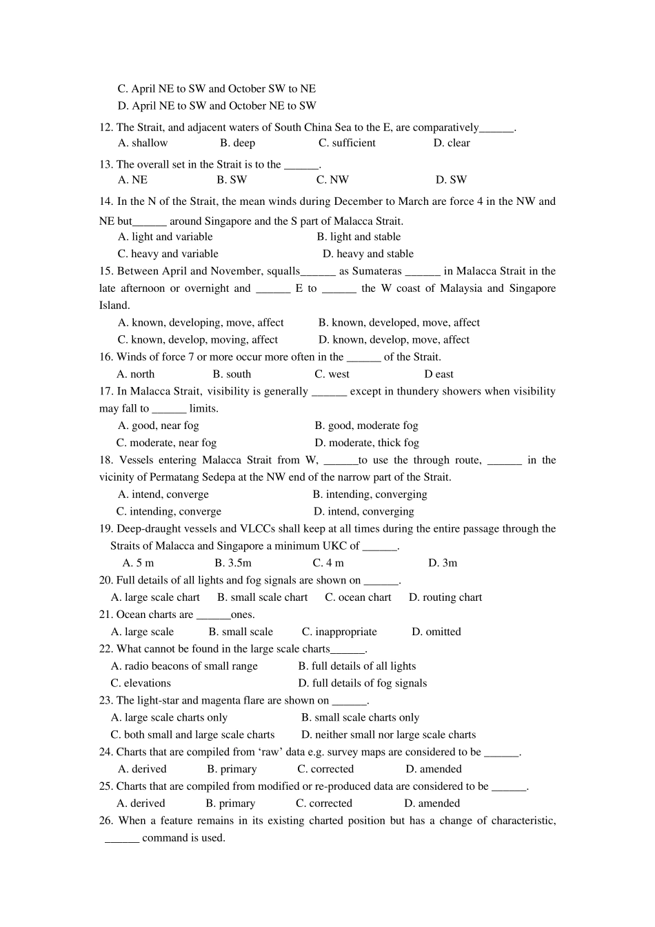
航海图书资料 1. ______ is the main channel of water exchange between Indian Ocean and South China Sea. A. Dove Strait B. Malacca Strait C. Taiwan Strait D. Turkish Strait 2. The Passage Planning Charts which show the routes through the TSS in Malacca Strait and Singapore Strait can be found in ______ . A. The Mariner’s Handbook (NP 100) B. Ocean Passages for the World (NP136) C. Mariners’ Routeing Guide (chart 5502) D. Symbols and Abbreviations used on Admiralty Charts (chart 5011) 3. Malacca Strait may ______ from W through Great Channel from the Indian Ocean, ______ S of Great Nicobar, and thence by passing N of Pulau Rondo. A. be approached, passes B. be approached, passing C. approach, passing D. approach, passes 4. Depths in the routes (Malacca and Singapore Straits) vary between 20 m and about 23 m but there are many areas of sandwaves and depths are liable to change. The statement infers that ______. A. depths in Malacca and Singapore Straits are stable B. depths in Malacca and Singapore Straits are changeable C. depths in Malacca and Singapore Straits are the same all the time D. depths in Malacca and Singapore Straits are invariable 5. Aids to navigation in the Straits are ______ to maintain and may be______. A. easy, reliable B. easy, usual C. difficult, unreliable D. difficult, unusual 6. ______ is a traffic monitoring system in Malacca and Singapore Straits, which also issues warnings to vessels. A. STRAITREP B. CALDOVREP C. AUSREP D. SAFREP 7. Full details of radio weather services, ______ diagrams of forecast areas for the Straits, ______ in Admiralty List of Radio Signals Volume 3(2). A. including, are given B. including, giving C. includes, are given D. includes, ...


