G217 国道南段沿线典型危岩体的稳定性分析摘 要:G217 国道横贯天山南北,沿线地质环境特别,生态条件恶劣,地形地貌差异较大,倒塌、滑坡等地质灾害频发,其中尤以倒塌灾害最为严重
据现场调查,目前仍存在多处危岩体,严重威胁行车安全
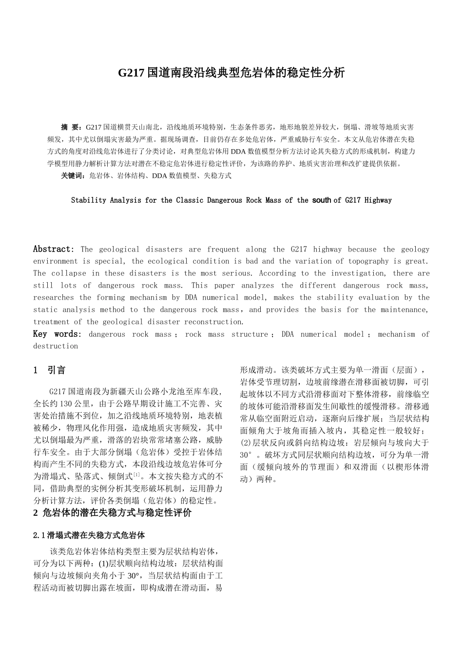
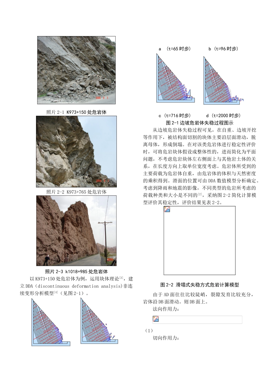
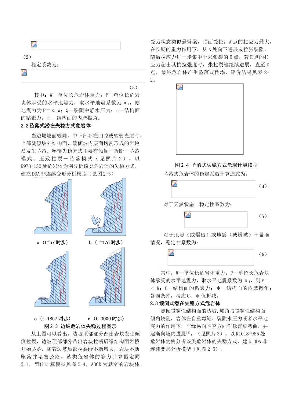
本文从危岩体潜在失稳方式的角度对沿线危岩体进行了分类讨论,对典型危岩体用 DDA 数值模型分析方法讨论其失稳方式的形成机制,构建力学模型用静力解析计算方法对潜在不稳定危岩体进行稳定性评价,为该路的养护、地质灾害治理和改扩建提供依据
关键词:危岩体、岩体结构、DDA 数值模型、失稳方式Stability Analysis for the Classic Dangerous Rock Mass of the south of G217 HighwayAbstract: The geological disasters are frequent along the G217 highway because the geology environment is special, the ecological condition is bad and the variation of topography is great
The collapse in these disasters is the most serious
According to the investigation, there are still lots of dangerous rock mass
This paper analyzes the different dangerous rock mass, researches the forming mechanism by DDA numerical model, makes the stability evaluat