John Snow and the Broad Street Cholera Outbreak of 1854Cholera reached the British Isles in the early 1830s, and outbreaks would continue for the next fifty years. Today, it is well known that cholera is caused by the bacteria Vibria cholerae and is usually spread in poor drinking water. Early theories blamed the infection on mists and 'miasmas', which led to many of the early attempts to control cholera failing. In reality the poor sanitary conditions of a city's water supply was responsible. Early Victorian cities also included cowsheds mixed in amongst the houses. These combined with poor handling of human sewage (often merely a hole in the ground) led to a rapid contamination of the drinking water. 
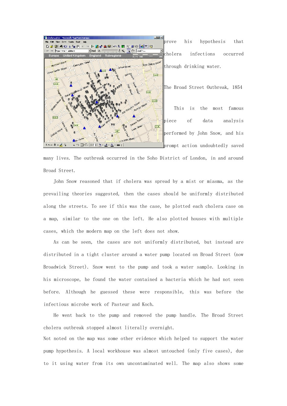
Indeed, the famous Broad Street water pump (see below) was a shallow water pump that pumped water from the contaminated water table. In the 1850s, John Snow performed pioneering data analysis to prove his hypothesis that cholera was spread in the drinking water. This analysis if performed today, would come under the realms of GIS (Geographic Information Systems) and Data Mining. Some have claimed his Broad Street map as being the first example of GIS, even though it was performed with a pen and paper. Although this is an exaggeration, the Broad Street map it is an excellent example of the power of maps to clearly demonstrate relationships in complex scenarios. Snow's work with the London cholera outbreaks of the 1850s, is often cited as the beginning of modern epidemiology. Unfortunately word of this pioneering epidemiology was slow to spread, and the London cholera outbreaks would continue into the 1880s when all of the shallow water-pumps were finally decommissioned. This page looks at S...